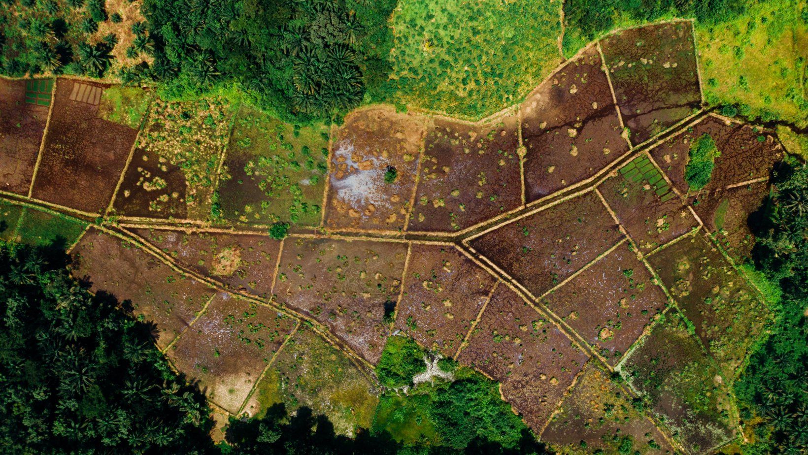
Aerial Surveys
Get a bird's eye view of the construction site! Aerial images and videos give a great overview of the project and can assist detect characteristics that aren't visible from the ground.
Our customizable flight capabilities allow us to return to the exact place throughout construction and record completion shots after the project has begun. To speed up and improve the correctness of your project, we may provide HD imagery and many design and engineering files. Today, aerial photogrammetry is the most used approach for mapping huge areas. Most national
mapping organizations still use aerial photography to maintain their topographic maps.
Aerial mapping or airborne laser scanning are commonly used to manage forestry inventories across Canada, where natural resources are crucial to the economy. In fact, aerial surveys are routinely used in mining exploration to study the terrain. Here at Vancouver Land Surveyor Pros, our technical staff possesses the necessary abilities, tools, and experience to provide a comprehensive set of mapping products. Our team employs the most up-to-date aerial and mobile technology to deliver precise and reliable data.
What Are The Benefits of Aerial Survey?
Unmanned Aerial Vehicles (UAVs) for surveying are becoming increasingly prevalent within the measurement sector. Here’s why an aerial survey is beneficial:
Accuracy
Drones now have cameras that can capture up to 5.2k definition photos and video because of rapid advancements in UAV and camera technology over the last decade. The higher pixel resolution ensures that aerial surveys are as accurate as possible. Also, advanced new stabilization techniques enable drones to shoot ultra-high definition photographs under adverse weather circumstances.
Overall, precision is one of the drone's major features, thanks to the reliability and rising prevalence of GPS, particularly real-time kinematic or RTK, included in some drone software. UAVs become a very appealing prospect for any aerial survey when accuracy is combined with other inherent advantages.
Occupational Health and Safety
Drones are good instruments for capturing data in compromised, risky, or sensitive settings, with minimum risk to the surveyor controlling the drone and the general public. All data is gathered from the air, with minimal health and safety risks. This minimizes planning time and eliminates the need for comprehensive health and safety concerns, resulting in a faster overall project turnaround.
Efficiency
Drones' versatility allows them to cover enormous swaths of ground in a short amount of time. Pre-planned flight paths further aid the speed with which a drone survey can be conducted. This cuts the time it takes from the start of the project to the final data processing and delivery of the finished product, assuring client satisfaction in time-sensitive initiatives.
Why Choose Us?
At Vancouver Land Surveyor Pros, we strive to be the best and constantly improve our operations to maintain a high level of client service. Also, we aim to develop long-term success and client relationships by emphasizing what our clients need over what they want. Want to know more about our services? We would love to chat!
How can we help!
Fill in the form or call to set up a meeting at 604-200-4103